
Protecting the environment and addressing climate impacts
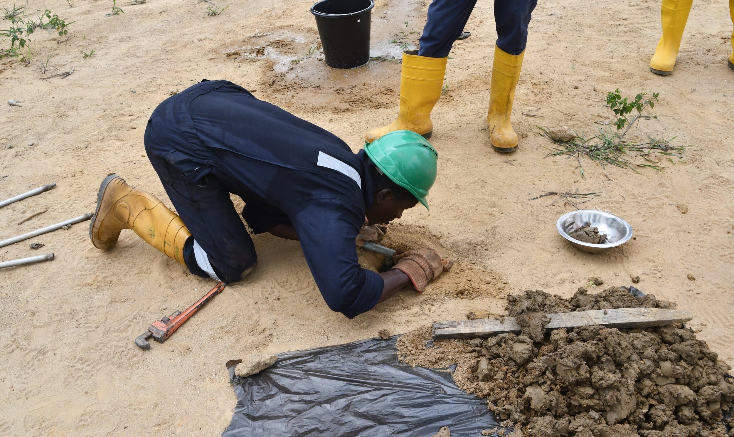
464+ Environment Monitors Trained
464+ Environment Monitors trained in technical remediation and deployed for the Ogoni clean-up exercise
3,000+ Soil and Water Samples
3,000+ soil and water samples collected and analysed to support the wider Niger Delta clean-up.
Environment & Climate): SEPAG — Environment Component
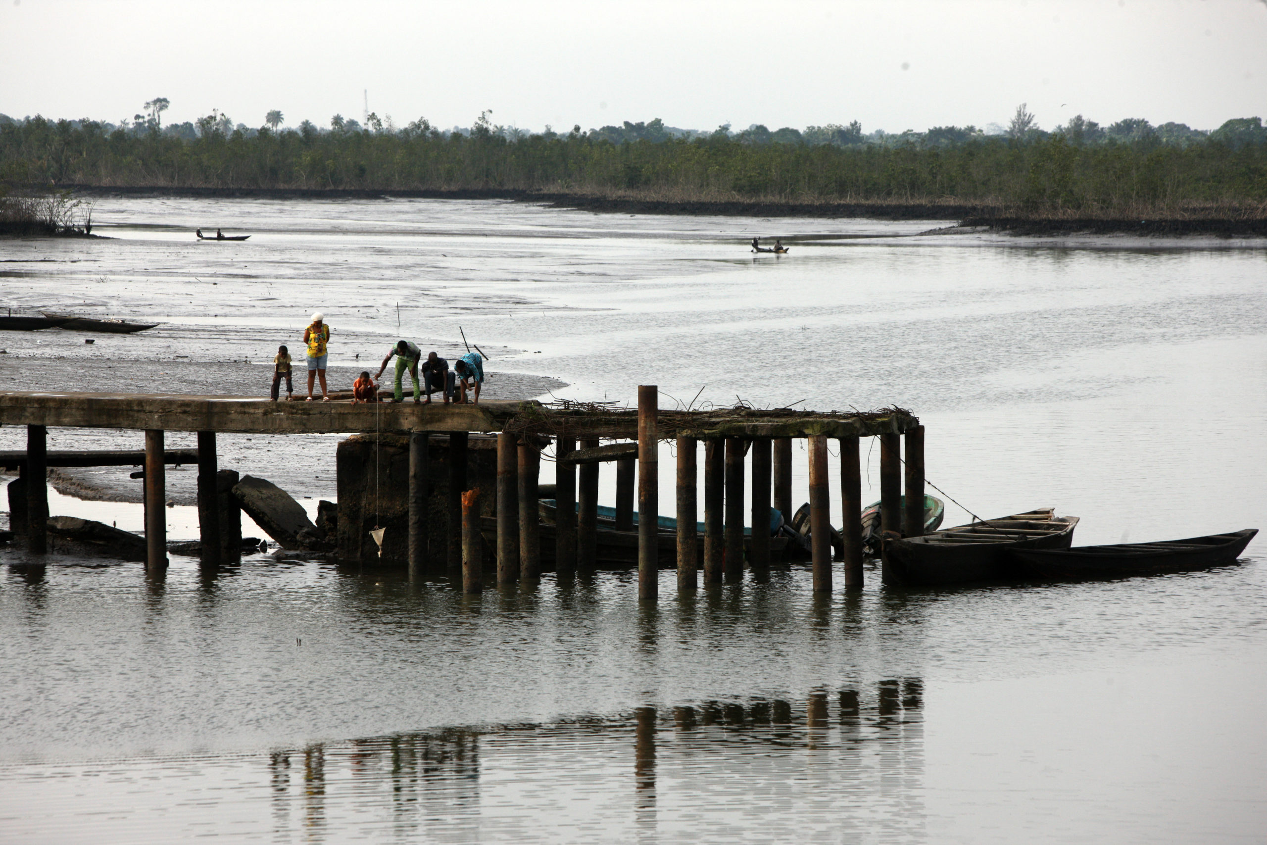
SEPAG (Strengthening Environmental Policy and Accountability in Governance) was implemented across two pillars with distinct activities: Good Governance led the Community Monitoring and Advocacy Groups (CMAGs) work across Bayelsa State (published on the Governance pillar page); Environment & Climate led independent monitoring of the Ogoni Clean-up and Remediation process, covered here.
Independent Monitoring of the Ogoni Clean-up (HYPREP)
Ogoniland’s oil pollution, laid bare in UNEP’s 2011 assessment, which found benzene levels in drinking water over 900 times WHO safety limits, is being addressed through HYPREP, the federal government’s dedicated remediation project. SDN has served as an independent civil society monitor of that process since its early phases.
What changed as a result of the project?
• SDN's monitoring directly led HYPREP to revisit 15 previously "remediated" lots for reassessment after SDN's field data found contamination still above the 1,000mg/kg safety threshold, and to direct contractors to carry out corrective action.
• Helped redesign HYPREP's key performance indicators toward more SMART, measurable monitoring standards, and shaped improved biocell construction and backfilling methodology to better support revegetation.
• Built the independent monitoring capacity of young women and men from oil-impacted Ogoni communities across five training cohorts (2020–2024), with an upgraded second-phase training delivered in 2026.
• Helped repair a strained relationship between HYPREP, its contractors, and host communities through stakeholder roundtables, directly informing HYPREP's approach to community engagement and post-remediation monitoring.
• SDN's public Tableau dashboard, live on the SDN website since 2022, brought public transparency to a clean-up process that previously had almost none.
Support this work:
Fund continued independent monitoring of the Ogoni clean-up and protection of newly restored mangrove ecosystems from re-pollution.
Digital Innovation for Environmental Accountability
The Oil Spill Monitor: Making Oil Spill Data Visible, Accessible and Actionable
What changed as a result of the project?
The Oil Spill Monitor has documented thousands of oil spill incidents across Nigeria’s oil-producing areas, including more than 9,700 incidents between 2013 and 2023. Its records help users examine the companies involved, identify reported causes such as theft and sabotage, pipeline corrosion and equipment failure, and track investigation and clean-up responses. By making this information publicly accessible, the platform provides an evidence base for understanding pollution patterns, identifying gaps in response and strengthening environmental accountability.
How SDN supported or contributed to the change
SDN partnered with NOSDRA to develop a public digital platform that makes oil spill data accessible, strengthening environmental monitoring, transparency and accountability across Nigeria’s oil-producing areas.
When SDN began developing the Oil Spill Monitor in 2013, few publicly accessible digital tools existed for tracking pollution from Nigeria’s oil and gas sector. Information on oil spills from petroleum operations was largely held in institutional and paper records, out of reach of the communities most affected and the researchers and civil society organisations working to hold operators to account. SDN set out to change that, in partnership with the National Oil Spill Detection and Response Agency (NOSDRA), the federal regulator responsible for oil spill response in the petroleum industry.
The partnership built on early open-data work with NOSDRA from 2012, supported by organisations including Development Seed, Revenue Watch and the Facility for Oil Sector Transparency and Reform supported by DFID. Launched in 2014, the Oil Spill Monitor transformed NOSDRA’s records of spills from oil and gas operations into a searchable online map and database. For the first time, anyone could explore spills by location, date, operating company, cause, estimated quantity, and response status, and track whether investigations and clean-up had taken place. The platform was built to work even on unreliable internet connections, so that NOSDRA field officers could use it across the Niger Delta.
Putting the scale of pollution into view
The Oil Spill Monitor has documented thousands of oil spill incidents from petroleum operations across the Niger Delta and Nigeria’s oil-producing areas, including more than 9,700 between 2013 and 2023. That record shows which oil and gas companies are involved, what is causing spills, whether it is theft and sabotage, pipeline corrosion, or equipment failure, and how well incidents are being investigated and cleaned up. It also exposes gaps in reporting and response, which makes it a powerful basis for accountability. Because the platform draws on Joint Investigation Visits and is updated as investigations progress, it remains a living record.
From civil society innovation to regulatory tool
The Oil Spill Monitor is now more than a public website. NOSDRA took over its management, and offices across the agency use it to update spill information, while headquarters reviews and confirms records. SDN redeveloped the platform in 2018–2019, adding functionality and strengthening its role as the sector’s central tool for recording and responding to oil spills. NOSDRA staff report that easy access to data has accelerated decision-making, improved transparency and strengthened relations with host communities. The agency now counts the Oil Spill Monitor among its core systems for mapping, tracking and inventorying oil spill incidents. For communities, researchers and civil society organisations, the platform puts official spill information in the public domain, so they can follow individual incidents, understand pollution patterns and ask informed questions about investigation, clean-up and responsibility.
The Oil Spill Monitor showed what becomes possible when technology, open data and regulatory partnership come together. It also set the template for SDN’s wider work on pollution from the oil and gas sector, from the National Gas Flare Tracker to the Methane Tracker. Each tool makes an environmental problem visible, strengthens the systems that regulate it and gives the public the information to demand accountability.
Evidence: [Oil Spill Monitor]
Support SDN’s continued work to monitor and respond to oil spills across the Niger Delta.
Developed by SDN in partnership with the National Oil Spill Detection and Response Agency (NOSDRA)
The Gas Flare Tracker: Using Satellite Technology to Make Gas Flaring in Nigeria's Oil and Gas Sector Visible

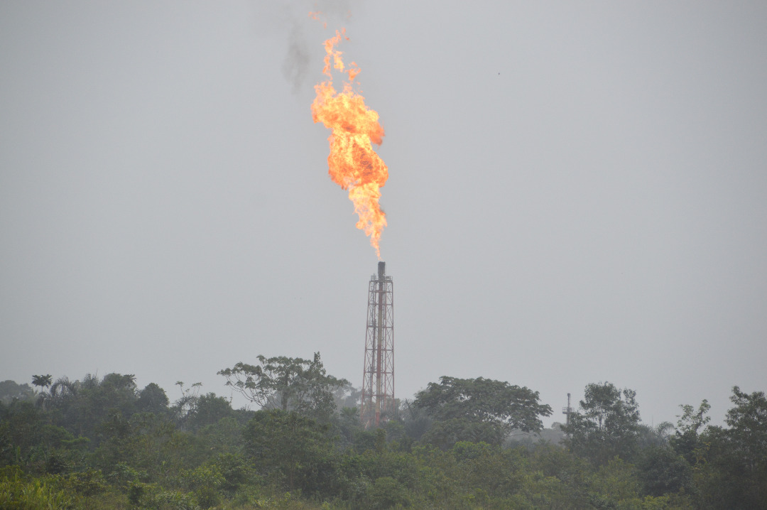
Gas flaring, the burning of associated gas released during crude oil production, has been a feature of Nigeria’s oil and gas sector since the 1950s. It has long carried environmental, health and economic costs for oil-producing communities and for the country. Yet when SDN developed the Gas Flare Tracker, reliable and publicly accessible information on where gas was being flared and how much was being burned was hard to obtain. The main field data available to government came from oil companies through the Nigerian National Petroleum Corporation (NNPC), and published figures were often delayed and difficult to analyse geographically.
What changed as a result of the project?
The Gas Flare Tracker provides an ongoing, satellite-based view of gas flaring in Nigeria. Its automated data feed updates the map every 24 hours as new observations become available, allowing users to monitor flare locations and changes in activity over time. By presenting satellite-derived estimates alongside the climate, energy and financial implications of flaring, the platform helps make the scale and consequences of the practice easier to understand.
How SDN supported or contributed to the change
SDN developed a satellite-based monitoring platform for NOSDRA that independently tracks gas flaring, providing evidence to support regulatory oversight, emissions verification and public accountability.
SDN introduced a different approach: using satellite technology to observe gas flaring across Nigeria independently of company reporting. The Gas Flare Tracker uses data from the VIIRS instrument on the Suomi National Polar-orbiting Partnership satellite, processed through the VIIRS Nightfire product developed by the Earth Observation Group at the Colorado School of Mines. New Nightfire data are produced every 24 hours, identifying the location, temperature, size and radiant heat of infrared emitters. The tracker processes this data for Nigeria to identify likely gas-flaring sites and estimate the volume of gas being burned, and these estimates feed into calculations of associated carbon dioxide emissions and the potential value of the gas. The result is an interactive map that lets users explore flaring by geographical area, oil field, and operating company; compare estimates across periods; and cross-check company-reported figures against satellite observations.
A live view of flaring in the Niger Delta
The Gas Flare Tracker is more than a historical database. It was designed as a live geospatial platform, supported by an automated satellite data feed that updates the map every 24 hours as new observations become available. This allows users to monitor where gas flaring is detected and track how flare activity changes over time. The tracker also presents satellite-derived estimates alongside the climate, energy and financial implications of flaring. Its latest published estimates indicate that in 2025 Nigeria’s oil and gas industry flared an estimated 17 million tonnes of CO₂, burned approximately $1.13 billion worth of potentially useful natural gas, and lost an estimated 32.3 thousand GWh of potential electricity generation. These figures are derived from satellite observations and are indicative estimates.
From civil society innovation to regulatory tool
SDN developed the Gas Flare Tracker for the National Oil Spill Detection and Response Agency (NOSDRA), with geospatial analysis by WebGeospatial and software development by Sentido-labs. NOSDRA manages it, and the Nigerian Ministry of Environment commissioned it. Its significance extends well beyond a public-facing map. It gives the regulator and other stakeholders an independent source of spatial evidence against which they can examine industry-reported data, in a sector where timely, location-specific information has been scarce. NOSDRA now draws on the tracker to verify flare volumes and carbon dioxide emissions, and its data are used in public reporting on the scale of flaring. The tracker was designed to help industry, regulators and civil society use evidence to improve regulation, incentives and investment aimed at reducing flaring, including efforts such as the Nigerian Gas Flare Commercialisation Programme. It makes it possible to ask not only how much gas is flared, but where, by which operators, and how the pattern is changing.
The Gas Flare Tracker showed how satellite data can become a practical tool for environmental accountability. Instead of relying entirely on information supplied by companies, regulators, civil society and the public can see an independent picture of flaring and use it to question, compare and investigate reported emissions. It also established a model for SDN’s wider innovation work: using technology to make pollution from the oil and gas sector visible, turning complex environmental data into accessible information, and strengthening the evidence available for regulation and public accountability. That approach has since informed SDN’s work on methane emissions tracking, extending the use of satellite and digital technologies from seeing where gas is flared to understanding a broader range of emissions from Nigeria’s oil and gas industry.
Evidence: [Gas Flare Tracker]
Support SDN’s continued work to track and reduce gas flaring in Nigeria.
Developed by SDN for NOSDRA; commissioned by the Federal Ministry of Environment
Strengthening Measuring Reporting and Verification for Short-Lived Climate Pollutants in Nigeria
Nigeria has a National Action Plan for reducing short-lived climate pollutants (SLCPs), including methane and black carbon. Effective implementation depends on reliable data and strong institutional systems for measurement, reporting and verification (MRV). Yet capacity, data availability, coordination and technical expertise vary considerably across government institutions and sectors.
With support from the Climate and Clean Air Coalition (CCAC), SDN implemented a project to strengthen the capacity of Nigerian government institutions to incorporate SLCPs into the national MRV framework. The project was initially designed to work with four Ministries, Departments and Agencies (MDAs). Strong stakeholder interest led to its expansion to 16 federal MDAs, covering key sectors including oil and gas, agriculture, livestock, transport, water and sanitation, environment, statistics, planning and finance.
What changed as a result of the project?
SDN conducted a comprehensive needs assessment across the 16 MDAs, examining existing MRV practices, institutional arrangements, data systems, technical capacity and reporting processes. The findings were consolidated into an institutional MRV needs inventory, identifying specific gaps and priorities for each participating institution.
How SDN supported or contributed to the change
SDN strengthened the capacity of 16 federal Ministries, Departments and Agencies to measure, report and verify short-lived climate pollutant emissions through institutional needs assessments, technical training and improved coordination, supporting the integration of reliable emissions data into Nigeria’s climate policy and reporting systems.
SDN conducted a comprehensive needs assessment across the 16 MDAs, examining existing MRV practices, institutional arrangements, data systems, technical capacity and reporting processes. The findings were consolidated into an institutional MRV needs inventory, identifying specific gaps and priorities for each participating institution.
The assessment provided the basis for a tailored capacity-building programme. Government technical staff received training on SLCP quantification using IPCC methodologies, MRV systems, data requirements, quality assurance and quality control, institutional accountability, data harmonisation and collaboration. The programme also created opportunities for peer learning, allowing institutions with more developed MRV practices to share practical experience with other agencies.
The project established stronger links between institutions responsible for generating, managing and using emissions data. Follow-up engagements found that participating MDAs had begun acting on the recommendations, including improving internal data processes, strengthening QA/QC arrangements, developing sector-specific reporting approaches and improving coordination with other agencies.
The project also strengthened understanding of the different roles required within a national SLCP MRV system. Regulators, statistical agencies, policy institutions and sector ministries each hold different parts of the data and reporting chain. Bringing these roles together is essential for producing credible and usable national emissions information.
The intervention has strengthened the readiness of the National Council on Climate Change and 15 other federal MDAs to operationalise SLCP MRV in line with the overarching institutional framework. It also created a stronger foundation for integrating SLCP data into national reporting, policy development and climate planning.
The experience showed that building an effective MRV system requires more than technical training. It requires clear institutional responsibilities, reliable data flows, quality control, sustained coordination and continued technical support.
Support the next phase of Nigeria’s short-lived climate pollutants Measuring Reporting and Verification development, including stronger sectoral systems, digital data infrastructure and engagement with subnational institutions closer to emission sources.
The Niger Delta is one of the world’s most environmentally degraded oil-producing regions. Decades of oil and gas extraction have left communities dealing with oil spills, gas flaring, damaged mangrove ecosystems and other forms of pollution that affect health, livelihoods and food security. Climate change is adding to these pressures, while emissions from the oil and gas sector continue to contribute to Nigeria’s climate challenge.
SDN works to reduce the environmental impact of oil and gas operations and strengthen the systems needed to monitor, regulate and address pollution. We support communities to monitor environmental conditions, promote transparency around oil spills, gas flaring and methane emissions, and engage regulators, companies and other national, subnational and regional stakeholders to improve environmental accountability. Below are some of our flagship projects driving this work.
COMPLETED
LIVE
COMPLETED
This project which will be implemented in three Niger Delta states (Bayelsa, Delta and Rivers in six host communities: Otuasega, Imiringi, Eruemukhuwarien, Owevwe, Umuebulu 2-Oyigbo and Komkom, with an estimated population of 250,000)...
LIVE
The aim of this project is to ensure communities in the Niger Delta fairly benefit from the proceeds of the oil and gas industry and that local and global environmental impact...
COMPLETED
This project aims to improve the natural environment in the Niger Delta, and the quality of service provision by government and other institutions in the area.
COMPLETED
This project seeks to update our existing research on the current challenges communities living in the Niger Delta face claiming—and receiving—fair compensation for oil spills impacting their land and livelihoods...
COMPLETED
COMPLETED
COMPLETED
Related Resources


